扫一扫,手机访问本帖 
|
本周六(5月10号)活动召集: Sumas Mtn day hiking from fr Sumas Mtn Road
路线描述:
http://www.vancouvertrails.com/trails/sumas-mountain/
Driving direction in google map:
http://goo.gl/hYjF6L
Driving Direction in PDF:
https://dl.dropboxusercontent.co ... iving_Direction.pdf
hiking route & waypoints in google map:
http://goo.gl/4OAMvJ
集合时间地点是8:00am Production Skytrain Station, Free Parking on both sides of Production Way (See details in the map below)
要Carpool的同学可以坐sky train到集合地点
描述: 红线为 Free Parking 区域,no time limit, 准确集合位置见 Meeting area 箭头所指

Carpool fee: $15
Round trip: 13.7 Km
Elevation gain: 700+ m
相关链结:
http://www.clubtread.com/sforum/topic.asp?TOPIC_ID=61317


How to get to Sumas Mountain
Sumas Mountain is located just east of Abbotsford and can either be hiked from the west or the east side of the mountain. To reach the trailhead of the western approach, take Highway #1 (Trans Canada Highway) east until you reach the town of Abbotsford. Take the Whatcom Road (Exit #95) turnoff and turn left, crossing over the highway overpass. Just after the overpass, make a right-hand turn onto North Parallel Road as it follows alongside the highway. After 2km, turn left onto Sumas Mountain Road. Continue along Sumas Mountain Road for 9km. For the last 0.5km, the road becomes gravel. After making a sharp right-hand corner that heads downhill, the road curves to the left. The trailhead is located in the outer part of this left curve where the gravel has been widened to give space for hikers to park their cars. Look closely for the coloured trail markers as they are easy to miss.
View a map of Driving directions to Sumas Mountain:
http://maps.google.com/maps?daddr=49.122236,-122.188343
必需物品:
1> 高幫防水hiking boots
2> Gaiter, 防濕鞋濕褲又能防髒 ((此trail泥泞)
3> 一對登山杖
4> 手套+帽 +保暖衣服
5> 午餐 + 零食
6> 防雨防風外套
7> Day hiking背包 +rain Cover
8> 墨鏡
9> 哨子
10> 防曬霜
11> 2+升 水
12> 相機 / 電池 / 記憶卡
13> 頭燈
14> 基本急救用品
***请各位参加活动的队友把贴出来的相关信息说明都认真地读两遍,司机请熟记一下贴出来的驾驶路线,各位坐客也请帮看路。
***提醒新参加活动的朋友准时集合-可以早到不要迟到
***需要CARPOOL的朋友準備兩雙鞋(一雙是登山鞋),在開始Hiking前和結束後,換上乾淨的鞋,這樣省去車主打掃車內衛生,謝謝!還可以再準備備用的襪子和零时替换的衣服。爬完山能舒服一下也是種享受.
Sumas Mountain is one of the most familiar mountains in the Fraser Valley. Located along the north side of the Trans Canada Highway between Abbotsford and Chilliwack, the Sumas Mountain Trail is also part of the Centennial Trail.
From the trailhead, make your way into the forest. The trail can be quite muddy in places, particularly in the spring or after a rainfall. The trail weaves its way through the forest until after 10 minutes where you make your way down into a ravine. The trail crosses a well-worn bridge. Enjoy the cool, fresh air the river brings as the majority of the trail will be uphill from this point forward.
Make your way up out of the ravine and ascend through the forest. Parts of the trail are very narrow from the overgrowth of plants and trees. The land comprising of Sumas Mountain is disputed as to what jurisdiction it belongs to as well as having a claim by the First Nations to land ownership. It's due to this dispute that the trail is not as actively maintained as many others.
After hiking for about an hour, you will reach a gravel road where a section of trees has been clear-cut on the left. This is an unfortunate view along the trail. Walk about 40 meters to the right along the road to where a sign points to the continuation of the trail on the left. Enter the forest again and continue ascending as you take in the fresh scents of the forest.
After 20 minutes, the trail levels slightly and continues alongside the mountain. Make sure to always check that you are following the orange markers as it is easy to become disoriented in the trees and lose the trail. Keep an eye open to your left as you may catch the occasional glimpse of the Fraser River below.
The trail continues gradually going uphill and crosses another creek. After hiking for 45 minutes or so, you arrive at the calm shores of Chadsey Lake. This beautiful lake is nestled in between thick Douglas Fir trees with Sumas Mountain towering in the background.
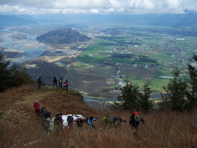
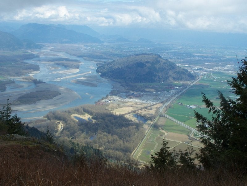
Walk around to the opposite side of the lake where a trail begins that climbs to the peak of Sumas Mountain. This trail can be steep, narrow, slippery, and sometimes poorly marked so use caution when climbing to the top. About 30 minutes up, a clearing offers a scenic view of the Fraser River and surrounding farms. Continue up the trail for another 30 minutes before reaching the peak. On a clear day you can see views of Mount Baker, Chiliwack, and the surrounding Fraser Valley region.
After taking in the views, begin your descent back downhill towards Chadsey Lake. Make sure to take the same trail that you used to arrive at the lake (western approach) then make your way back to the dirt road and eventually back to where you parked earlier in the day.
From Chadsey there is a loop trail to the Summit Lookout. You can go left or right at the lake. The right trail has less grade and recommended when going up. It comes to a road where the old parking area is. Go left up the road for 1 kilometer to the trail to the Summit. Good views of the Eastern part of the Fraser Valley.
If you go left at the lake the trail is much steeper. It has some good views of the lake and Western part of the Valley.
Both directions join just before the Summit so it can be hiked as a loop back to the lake.
See Chadsey Lake Loop for more trails in the area.
http://www.clubtread.com/Routes/Route.aspx?Route=87 |
|