扫一扫,手机访问本帖 
|
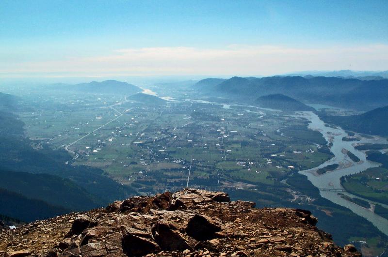
Day hiking this Saturday (Aug,24)-- Mt. Cheam & lady peak in Chilliwack area
Trail Info:
http://www.clubtread.com/Routes/Route.aspx?Route=73
Trail海拔最高点:2112米
Trail的拔高:715米
驾驶路线:
Travelling east on Highway 1, take exit 119A(Sardis, Cultus lake). Drive south through Sardis and Vedder Crossing to the bridge over the river, which is known as Chilliwack River Upstream of the bridge,Vedder River downsteam.Turn left and zero your Odometer here. This is Chilliwack lake road. Driving about 28Km(17mi), and just after acrossing the Chilliwack River(river-left to river right), turn left onto Chilliwack-Foley Forest Service Road. Cross Foley Creek after 2km(1.2mi) and go left at the T-junction. After another 2Km you cross the chipmunk creek bridge. Just uphill from the bridge, go right and uphill onto Chipmunk Creek Forest Service Road. Stay on this logging road for almost 7km before go right on a very steep and rough road for another 4km, if your Vehicle can handle it. The parking area is before a barrier about 1km from the end of the logging road
Note: The forestry service road to Mount Cheam has been deactivated for several years, and therefore to reach the trailhead requires a 4-wheel drive truck. A car will not make it through the numerous washed-out sections, creeks to drive across, large ditches, and big rocks along the 15km rugged road. Be prepared and use an appropriate off-road vehicle.
The access point to Mount Cheam is located along the highway to Chilliwack Lake. From Vancouver, take Highway #1 (Trans Canada Highway) east for about 90km to Exit #119 Sardis. Turn right and follow Vedder Road southbound until you reach a 3-way intersection at Chilliwack Lake Road. Turn left and zero your odometer. At 28km, turn left onto the Foley Creek Forestry Service Road and drive for 2km. After crossing the bridge, turn left at the junction and drive another 2km and then turn right onto the Chipmunk Creek Forest Service Road. There will be a gravel pit at this location. From this location, continue on the narrow road as it becomes very rough and follow it for about 8km to the end parking area. There are several turnoffs along the route, however stay along the most obvious road and it will take you to the trailhead.
温城
MT Cheam,来自Halkomelem的语言,意为“place to always get strawberries",但也有意为特指菲沙河谷.....
Highway 1 east到119口下到chilliwack,沿着标志走到Chilliwack lake Road,不过桥,把汽车公里表按零,大约开25公里左右,注意路左边的Foley creek forest service Road, 转入,大约行驶2公里,穿过foley creek,在T字路转左,再行1.5公里或者更远,转右上到Chipmunk creek forest service,在岔路口大约写着6公里牌子的路上,一直沿着右边行驶,大约2.3公里,转右沿着MOUNT CHEAM的标记,再然后,沿着左边行驶,大约2.7公里的距离就会到达停车场......
CPS data of Cheam peak Trail and driving direction in google map:
http://goo.gl/maps/QGb8i
Tracks of Cheam peak Trail and Lady Peak route:
http://goo.gl/maps/DNUC9


 |
|